Now shipping to Australia 🇦🇺 Canada 🇨🇦 New Zealand 🇳🇿 and United States 🇺🇸

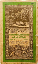
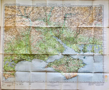
Ordnance Survey Map of the Isle of Wight, printed on paper, 1929 - The Seaview Collection
  • Load image into Gallery viewer, Ordnance Survey Map of the Isle of Wight, printed on paper, 1929 - The Seaview Collection
  • Load image into Gallery viewer, Ordnance Survey Map of the Isle of Wight, printed on paper, 1929 - The Seaview Collection
  • Load image into Gallery viewer, Ordnance Survey Map of the Isle of Wight, printed on paper, 1929 - The Seaview Collection
  • Load image into Gallery viewer, Ordnance Survey Map of the Isle of Wight, printed on paper, 1929 - The Seaview Collection
  • Load image into Gallery viewer, Ordnance Survey Map of the Isle of Wight, printed on paper, 1929 - The Seaview Collection
  • Load image into Gallery viewer, Ordnance Survey Map of the Isle of Wight, printed on paper, 1929 - The Seaview Collection

Ordnance Survey Map of the Isle of Wight, printed on paper, 1929

Regular price
£16.00
Sale price
£16.00
Regular price
Sorry - sold
Unit price
per 
Includes taxes

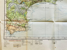
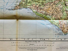
Ordnance Survey Road Map of 'Southampton, Portsmouth and the Isle of Wight' published in 1929 and printed on paper.

The scale is 1/2 inch per mile and covers the whole of the Isle of Wight.

A lovely vintage map for you, your family and friends to enjoy. In beautiful condition for its age and very suitable for mounting and framing.